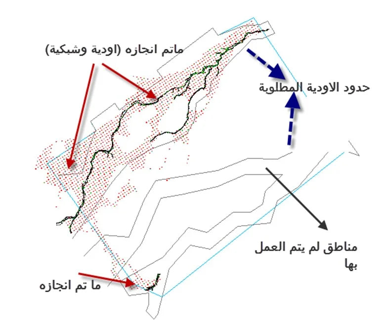
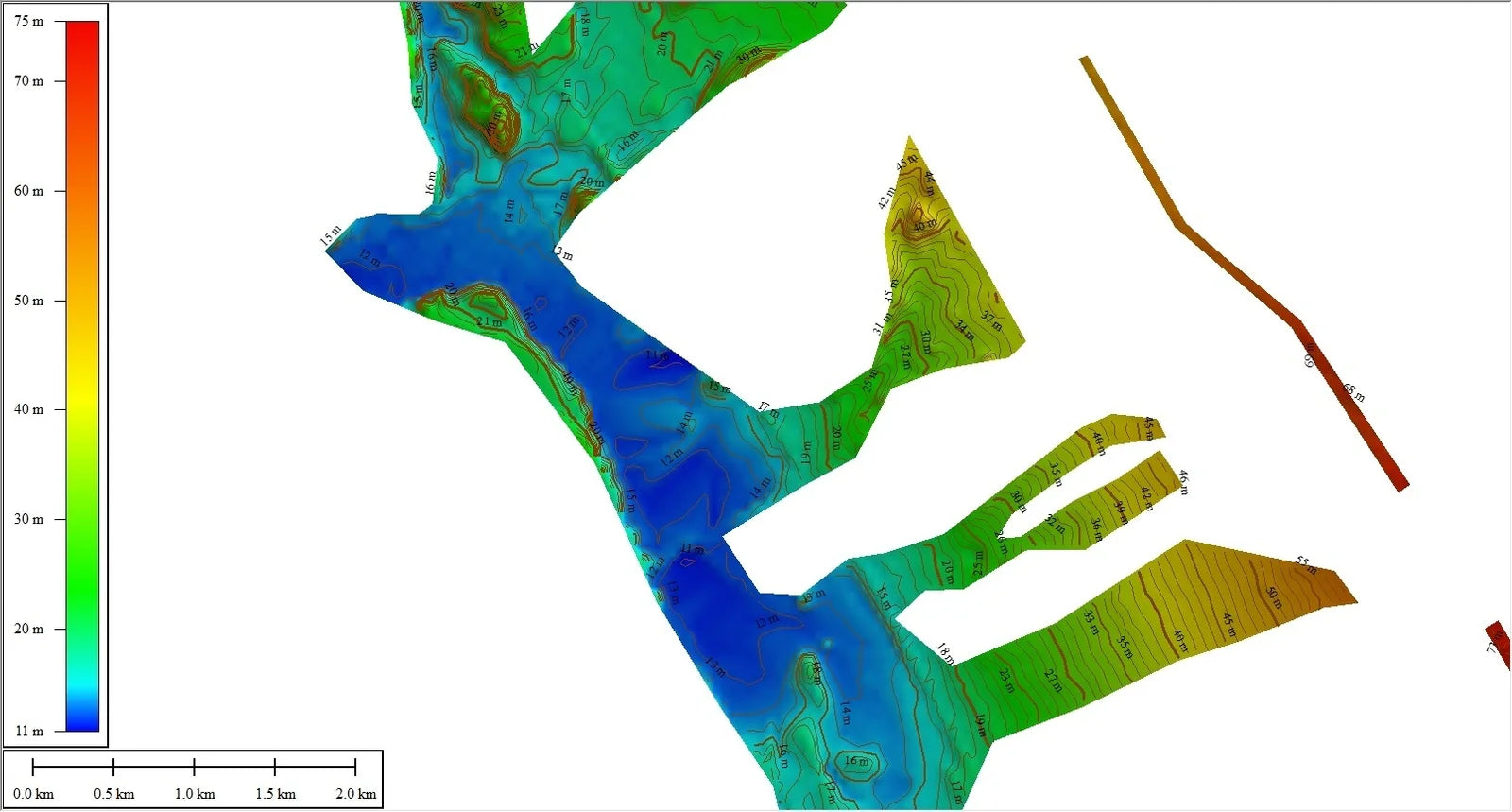
تقييم اتجاهات الوادي والشعاب المرجانية وتحديد المناطق المعرضة للفيضانات
| Client: | Saudi Geological Survey |
| Corporate: | Dar Geomatics for geographic, surveying systems and maps |
| Location: | Medina, Tabuk and Al-Jawf |
| Project Area: | Environmental Hydrological Consultation |
| Year: | 2018 |
| Project status: | Completed |
Our project at Future Cities for Engineering Consultations focuses on mapping the paths and sanctities of valleys and reefs, identifying regions at risk from torrential rains. Utilizing advanced geo-informatics, we analyze topographical data to understand the natural flow of these areas, crucial for urban planning and environmental safety. This initiative aids in the development of effective land use strategies and emergency preparedness, aligning with our commitment to create resilient and sustainable urban environments in accordance with Saudi Arabia's Vision 2030.
×
![]()